Road Trip

Our time on the Kenai Peninsula was spent fishing three different streams and on a “road trip” to Seward.  We blogged about this in our “Alaska – Part 4” post with a little in the “Alaska – Part 2” post, when we also went to Denali National Park and Talkeetna.    However, we could only include 5 pictures on the blog posts then due to internet restrictions…. so… we hope you enjoy the Kenai Peninsula Highlights music video we put together with many more pictures… and…. a bear cameo to boot!

Ramble On!

The phrase “Opening Day” conjures up a variety of images and emotions.  For baseball fans like our dear friend James Kelley, it’s all about baseball.  I’m sure for hunters, “opening day” brings vivid memories of deer, elk, pheasant and more.  For anglers, it’s the promise of hungry, eager, more gullible fish who’ve not seen any pressure from fishermen for many months.  Opening Day for fishing in Yellowstone National Park is always the Saturday of Memorial Day weekend.  Since I was in Bozeman this year…… ROAD TRIP!

Before I begin, a quick thought about “Road Trips”.   They aren’t totally about the destination you’re heading toward…. and….. in many cases they are MORE about the journey than the destination.  So, while my destination was the Firehole River in YNP, the journey to get there was just as important.

Having fuel is, of course, a requirement for any road trip but I’m not talking about gasoline, I’m talking about the kind of fuel that keeps YOU going…. food!  My first stop on the way to the West Entrance of YNP was our regular spot, Mama Mac’s at Four Corners.  Four Corners really isn’t a town at all; officially, it is termed a “census-designated place”  at the intersection of US Highway 191, MT 85 and MT 84…. 29 miles to the west is Norris Hot Springs and the Madison River, to the east 7 miles is downtown Bozeman, to the north 9 miles is Belgrade and 82 miles south is the West Entrance of Yellowstone National Park.

At Four Corners you’ll find gas stations on three of the corners, a bar/restaurant/casino on the other corner and two great fly fishing shops, Fins and Feathers and River’s Edge West, right next to Simms Fishing headquarters.  But I digress, this first stop is really about fuel for the stomach and Mama Mac’s.  When do we most often stop here…. breakfast….. for what?… a giant breakfast burrito or their special breakfast consisting of eggs, meat of your choice, hash browns, biscuits and gravy.   If you go, I’d recommend splitting either of these with your fishing buddy, the servings are huge.   It’s all cooked to order, served with a smile and stick to your ribs good.

After fueling up at Mama Mac’s, it was back onto US 191 heading south.  After crossing Spanish Creek just before it enters the Gallatin (a fav fishing spot) you enter the “Canyon” area in which US 191 parallels the river with usually only a guard rail between you and the river.  This whole section of the river fishes very well at certain times of the year and we have many pull off spots where we park and drop down into the river to fish.  This trip, I was alone as Barb was back in Missouri visiting family over the Memorial Day weekend.  However, all along the drive on this stretch, I could STILL hear Barb saying “keep your eyes on the road!”.  She knows I like to take a peek to see how the river flows are looking.  Barb…. I was good….. well, ok…. pretty good.

In fact, I was so good that when I wanted to really look, I pulled over and got out of the car to take a peek at the river.  There was this one spot I really wanted to see how the river was flowing; the rapids at House Rock.  As you can see when you look at the House Rock Rapids Video I’ve posted on Vimeo, the rock is literally as big as a small home and at this flow, you really can’t see it all.  Amazingly, with our good friends Ted/Deborah Watson and Don/Kim Freeman, we actually rafted this area a couple of years ago, and while it was definitely NOT at this flow, it was still a bit scary, especially as half of our boat (Ted, Kim and I) had already been tossed into the river at a much less treacherous spot.  Anyway, Watsons and Freemans… I hope you are watching this…. and cringing like I was when I shot the video.

The next stop along the way is often the Big Sky Conoco Travel Shoppe at the turnoff to the Big Sky Resort.  It’s about half way between Four Corners and West Yellowstone.  While we rarely get gas here, having already filled up at Four Corners, it has a great convenience store, a respectable little grill for burgers with a few tables and most importantly, pretty clean bathrooms.  I’m sure you can see the logistics in all of this, right?  Four Corners…. Mama Mac’s…. pit stop half way…. it just works perfectly.

Back on the road, still headed south toward West Yellowstone, you actually cross into Yellowstone National Park for a bit.  Not exactly sure why at this point you pop into the park and then back out before West Yellowstone, but you do.   There is some great fishing in the park section of the Gallatin, and if you’re ever this way, make sure to stop in at Wild Trout Outfitters in Big Sky, right on 191, and see JD Bingham.  He’ll get you the right bugs and give you great Gallatin River fishing tips.  His best one is “walk to fishing spots where you cannot see the road”.

When I finally pulled into West Yellowstone (MT), I did a U-Turn on 191 and pulled up in front of Blue Ribbon Flies.  I was greeted by our friend, Aaron Freed, who has been an invaluable resource in getting us the right flies and sending us to the best locations to fish.  While we talked a lot about our past fishing adventures and caught up on present activities, I was excited to tour the fly stand to pick out some flies for the day’s fishing.  After picking up a few dries and a few wet flies for swinging, I jumped back in the Suby and headed for the West Entrance to YNP…..

And stopped!  Traffic to get into the park was horrendous and backed up past the stop sign back in downtown West…. at least for a mile.  However, being the experienced traveler to these parts, I knew a secret way to cut a bit of time off the wait… and having a Senior park pass, I was able to get into the “fast lane” and make it into the park in about 10 minutes, which as it turned out, really didn’t help me much.

About a mile after entering the park, and being able to drive at the posted park speed limit of 45 mph, I again came to a full stop.  And for the next 12 miles, never got out of second gear (yes, the Suby Crosstrek is a stick so we can tow it behind the SaraLinda).  As a matter of fact, I drove in first most of the way, when we were actually moving.  I knew it had to be an animal jam but thought this one must be big… bears? wolves? moose?  After nearly an hour of “driving” along the road from West to Madison Junction in the park, I came upon what was causing the delays, two bison, just walking down the road, oblivious to the traffic; they were both walking the center line, letting cars pass SLOWLY (aka. stopping to take pictures) as they sashayed their way down the road.  The old saying from the classic Seinfeld episode kept playing in my mind “Serinity Now! Serinity Now!”, but I was already at “Hoochie Mama!”.

Which brings me to our next regular stop (yes Barb, I really missed you this trip, but we’ll be back when you return to Bozeman), the Madison Junction “rest stop”.  I truly needed a stretch after “driving” for well over an hour to traverse the 14 miles from West to the junction as well as a “rest” after drinking the coffee I’d filled into my Yeti at one of those coffee huts.   And while this “rest stop” is a fixture on our trips into the west side of YNP, stopping here always makes us smile, which is why you’ll find a picture of the trash container in the video above.  On one trip, we’d brought some trash in a black trash bag with us, as well as good friend James Kelley’s boots and waders, also in a black trash bag…. can you see where this is going yet?  Yes….  I tossed the wrong bag into this dumpster, and in went Kelley’s wading attire.  The dumpster will live in infamy.

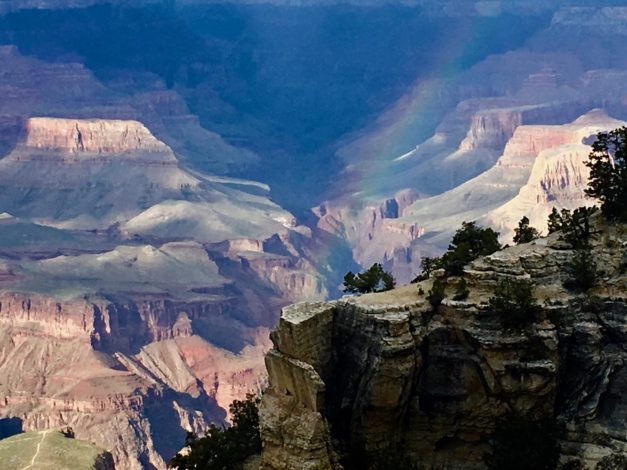
Turning right out of the Madison Junction “rest stop” parking lot, I ventured onto the southern loop road toward Old Faithful, crossing the Gibbon River and climbing up a long winding hill before reaching a plateau.  At this point, the road joins the Firehole River.  The Firehole really only fishes well from Opening Day until it just gets too warm in August, and then cools down in the fall to fish well again.  It’s not just the warm temps that make this river get too warm to fish in summer, it’s because so many thermal features in the park empty into the Firehole.  Aaron had hinted I should fish soft water near the banks, so, the first pull off I found, I parked in a spot Barb would have never let me pull off, given it had a 4-6” lip that dropped onto gravel just about the width of the Suby before falling down rocks into the Firehole.  The spot wasn’t one we’d ever fished before, as we often went for slower flow sections to spot rising fish.  As you see when you watch the video, this spot had fast rushing water that slowed only partially, but slowed enough.

Scrambling down the rock embankment, I found a spot to stand, tied on one of the wet flies Aaron had recommended, and on the first cast felt a slight tug.  Hmmmmmmm… I thought… I have to remember how to set when swinging wet flies.  Another few casts and I actually saw the trout come up to eat the wet fly as it rose on the swing.  A beautiful, 12” brown trout had been enticed as the fly had risen in the water column.  After a brief fight, I got him in, kept him in the water, removed the fly and let him go.  Yes James!….. I mistakenly threw your waders and boots away and do realize that a fish without a picture is JUST a story…. lol… You see, James is one of our dearest fishing buddies (a post on this subject to come soon) and his line about “just a fish story” is always with us.  In this case,  I was fortunate to repeat this cast a quarter downstream….. hold tight… swing… and fish one one more time before deciding to move on.

Moving on, I found another thing Aaron warned me about, the river was going to be crawling with anglers…. after all…. it was Opening Day!  Every single pullout along the road between my first stop and the turn off to Old Faithful was filled with cars, not sightseeing mind you, but fishing.  I saw anglers in various stages of suiting up and gearing up at each spot, or looking toward the water, already in what seemed good holding water.   Given it was already 2:00 and the Mama Mac’s burrito was wearing off, I decided to head to another of our “must stop” spots along this route, Old Faithful Inn and the Hamilton Store.

This is hallowed ground to us that draws us back every time we are even close to it.  We’ve had friends who’ve worked here and our daughter Krista even worked a summer and WINTER here at Old Faithful… the summer at OFI and the winter at Snow Lodge.  If there is one thing you do once you get into the park, it’s just step inside the Old Faithful Inn… and take it all in.  But again, sorry, I digress.

I decided to stop in the Hamilton Store and grab a sandwich, chips, cookie and drink to go; it’s what Barb and I always do if we haven’t made our own sandwiches.  I wanted to take it back to the Firehole, find a spot to pull off if I could, and have lunch next to the river, scouting for rising fish.  As I was checking out, I couldn’t help but notice tables of diners eating their lunches in waders.  What I realized at that moment was, Opening Day really wasn’t about the fishing, it was about the experience of Opening Day…. the camaraderie, the bonding, families together, parents and children fishing for perhaps the first time or the hundredth time.  Truly, “Its Not About the Fish”.

I found a parking spot near a tall stand of pine trees, and after I found a spot to put my chair that didn’t have a mound of somewhat fresh bison “poop” near it, I settled in for lunch.  It was peaceful and relaxing to just watch the river flow by.  A few years back, at this very spot, Barb and I were fishing when two bears appeared on the opposite bank. It’s always fun to be the first to spot animals, especially bears, as they emerge into the open.  That time, within minutes, there were bear jams in both directions, but we’d gotten to watch them for a minute or two, just us.  Again digressing here, but it really isn’t just about fishing, but the memories.

This time, no memories in this spot, other than of a great, store bought chicken salad sandwich.  There were no rising fish, no bears, nada, zip, zilch, nothing…. which in some respects made it….. perfect!  Just lunch and a lazy Firehole River flowing.

After lunch I headed back to the spot where I’d caught the two brown trout earlier, partly because I knew if two fish were there, the likelihood of even more fish being there was good….. and partly because again, all the other pullouts were taken.  This time, after a dozen or so casts, and trying two different wet flies, finding no takers, I moved on.

When I’d originally driven into the park, I noticed someone fishing a spot on the Madison River where in the past, Barb and I had slayed’em, thanks to our guide, Patrick Daigle, out of Blue Ribbon Flies.  Granted, when we fished with Patrick it was in October, and big fish had moved out of Hebgen Lake into the Madison and this was late May.  However, I had to stop and try, right?  Also, there was a herd of bison directly across from me, so I had built in fishing buddies…. sort of.  They seemed much more interested in just resting and every so often, nibbling at the grass or butting heads with one another.  After no bites, and realizing I had a two hour drive back to Bozeman, I decided to head out.

It had been a great “Opening Day”, not because of the fishing, but all of the other things encountered along the way.   The sights, the sounds, the air, the water…. even the SLOW traffic all contributed to a memorable day.  But I knew there was one more stop to be made, another of our favs.

Often, after a day in the park, we’ll be heading back to Bozeman, feeling a bit hungry or thirsty, and make a stop at The Corral.  It’s a friendly spot where locals and tourists alike are welcome.  It’s great food, cold beer and right up our alley.  There are snazzier places along the route back, but this one seems like home to us.  This trip, just to quench a thirst, I stopped in for a cold PBR.  You might be thinking, PBR?  Really?  To paraphrase a famous beer drinker, “I always drink local beer…. but when I cannot drink local…. I drink PBR.”  It’s the “go to” beer of fly fishermen and fisherwomen in these parts.

Cheers to Opening Days everywhere… and….

Ramble On

As we made our way from the San Juan River to Bozeman, we happened to be going through Moab UT, which is base camp for many outdoor adventures, including trips into Arches National Park.  We looked at our fishing calendar which suddenly had a couple of openings due to SNOW on the Green River in Flaming Gorge and decided to hole up in Moab for a few days.

The first day we arrived in Moab, we parked the SaraLinda at the SlickRock Campground on the north end of town, nearest to Arches.  Once we were settled, we headed up to venture into the park for our first sojourn.  It was late, the park was closing at 7pm due to road work in the park, so we raced (at 45mph, park speed limit) deep into the park to see a few of the sights.  We walked about a quarter mile to get a better look at Double Arch (see Pic 1) and realized that we really needed to go all the way up into it to gain a greater appreciation of its size.  We also did our three nods looking up at Balanced Rock which we were told is actually the size of three school buses.  What our first day excursion told us was that we’d be spending at least a full day in this beautiful park.

The next morning we were up early and headed into the park again.  After stopping at the Visitor Center, we ventured up the winding road, heading again to Double Arch.  There were far fewer people in the park at this hour so our hike to the arch was much more peaceful (aka…. all the young ones were still safely in bed as were the tweens).  We made it to the base of Double Arch where Barb shook her head as I was determined to climb up inside the arch to get a picture looking out over the landscape.  It took a bit of “scrambling” but I finally made it (see Pic 2).  After slowly sliding back down on my backside, Barb and I headed off for the next set of arches.

Across the way from Double Arch are two “Window” arches aptly named, North and South.  What is amazing is that as you hike the path to see North Window Arch, you are looking everywhere to see where South Window Arch is located.  Nothing!  When we arrived at the base of NWA, I was able to coax Barb up under the arch for a picture taken by another hiker.  We traded a lot of arch pics with people from all over the world.

As we left NWA and thought we were headed for Turret Arch (the arch in our featured cover pic…that’s me inside the arch), disappointed we didn’t find South Window Arch, low and behold, it simply appeared, behind a rock.  Perspective was everything in seeing SWA as I later learned.  We continued to Turret Arch which turned out to be a very easy hike.  Again, Barb took in the view from a distance while I climbed up into the arch.  When I turned around, a beautiful view of BOTH “Window” arches appeared (see Pic 3).

After these three hikes, we were beat and ready for lunch.  We headed to an area in the park known as Devils Garden.  We grabbed a quick lunch of our usual PB&J, a few chips and an apple.  It’s our “go to” lunch everywhere… fishing, hiking, traveling and just hanging out.  We never get tired of it.

Our next hike was to Landscape Arch (see Pic 4) which is the longest arch of its kind in the world.  This was a longer hike, a bit of up and down, but not too bad.  On the way back I couldn’t resist running up a hill of sand weirdly tucked into the canyon walls.  On the way back from seeing Landscape Arch, we took side trips to Pine Tree and Tunnel Arch.

We had a bit of energy left in our tanks, so, we hit a few more arches before heading to a local brewery.  As we sat down and shared a nice Moab Brewery scotch ale, we looked at Barb’s watch and determined we’d hiked about 6 miles during the day… so, of course, we splurged with nachos to go with our brew!

The next day, we headed to yet another national park in the area, Canyonlands, as well as to a state park that got rave reviews, Dead Horse Point State Park.  The prevailing story behind Dead Horse Point State Park is actually pretty sad.

After another day of hiking, we made our way back toward Moab, our basecamp.  However, one more hike was in store for us.  We hiked up the side of a cliff; yes, even Barb had to climb this one, overlooking Moab to see some Native American petroglyphs (see Pic 5).  Very cool.  And we just had to make one more trip into Arches to see Delicate Arch which is the arch used in most all of the literature about the park.

Our time in Moab was done and we headed on to Bozeman for some fishing, R&R and seeing friends.  We had an “epic” day fishing on the Madison, but that’s another story.

Ramble On


After fishing the Lees Ferry Reach of the Colorado River with Lees Ferry Anglers, we took off for Navajo Dam, NM and the San Juan River.  Along the route, we noticed a right turn at Cameron, AZ that would take us to the Grand Canyon…. well, DUH!  Of course, we decided to head west to Grand Canyon National Park.

We arrived at Trailer Village RV Park inside GCNP around noon, got the SaraLinda setup and off we went.  We were anxious to get in as much as we could that first afternoon because the forecast for the next day was rainy and windy.  Nothing worse that hiking down a narrow trail with the wind blowing hard and the trail wet.  So off we went!

When we decided to go to the park, we consulted with our friends Chuck and Marty Raplinger, who’d actually hiked down to the bottom of the Grand Canyon with their daughters Christina and Jessica, a year ago.  They’d shared with us the details of their trip, hiking down Bright Angel Trail, camping at the base of the canyon, then hiking back up on Kaibab Trail.  Chuck told us the hike up was challenging, especially that last mile.  However, Chuck told us that a good hike might be the first mile down the Kaibab Trail to a viewpoint called Ooh Aah Point.

So, our first stop was the South Rim trailhead for the Kaibab Trail.  I knew Barb would be somewhat skeptical of hiking the trail due to it being narrow, with somewhat steep drop-offs and mostly, her fear of heights.  Not to be deterred, Barb and I started down Kaibab Trail for Ooh Aah Point (Refer to Pic 1 above – “Selfie”).  About 50 yards down the trail, Barb looked at me, said “give me the backpack”, and headed back up. .  She said “You go if you want, but not me!”   As I continued down the trail, I took a picture of Barb as she ascended the trail (Refer to Pic 2 above – “Bye”).  We were headed in opposite directions.

As I continued down the trail, two things struck me, first, the views were breathtaking.  Around each switchback of the trail, a new view unfolded with the shadows painting the landscape of the canyon in different ways.  Second, I knew that if somehow I’d convinced Barb to continue down the trail with me, she’d have already pushed me off the trail, down into the canyon.

Continuing on, I also noticed two kinds of hikers coming up.  First, those who’d hiked down to Ooh Aah Point; they were all smiling, a bit winded perhaps, but still smiling.   Then, there were those who clearly had hiked that day from the canyon floor, straight up the trail.  Now mind you, the Kaibab Trail, from the canyon floor up to the canyon rim is 8 miles long.  Those people were NOT smiling, most were breathing heavily and NOT wanting to say “hi” or even look up at you.  Their goal was simply to make it to the top.  Take a look at Pic 3 above…. this is the “Warning” sign along the trail.  It seemed a few of those coming up didn’t heed this warning.

The real crazies were those who’d decided to hike down to the canyon floor and back up in  one day.  Those, what is the right word…. um…… idiots, were the grumpiest of all.  You could easily identify them.  They had only a small backpack, if any at all, and were typically complaining loudly with their hiking partners… some very loudly.

In any event, I made it down to Ooh Aah Point, took my obligatory canyon photos and selfie (Refer to Pic 4 – “Ooh Aah”), took a sip of my water, and then headed back up.  About a quarter of the way up, I started to take stock of my breathing and the amount of water I had left in my liter bottle.  I started to wonder if others coming down were categorizing hikers coming up like I was.  I was hoping they would put me in the right class of those just hiking down to Ooh Aah Point, and not that “idiot” class.  I tried to make sure I at least smiled at those coming down as I gasped for air periodically.   Finally I made it to the top and hooked back up with Barb at the Visitor Center.

The remainder of our day was stopping at various lookout points along the Rim Trail.  We concluded our day by watching the sunset at Mather Point.  OK… to be honest, Barb had seen enough canyon views, she took the bus back to the SaraLinda and I met up with her after the sunset.

The next day actually turned out to be better than expected, other than it snowed on us several times throughout the day.  We went to the Desert View area of GCNP, climbed the watchtower there and took in more incredible views of the canyon.  We also stopped at more overlooks, especially stopping at those where you could actually see the Colorado River cutting its way through the canyon and one of the Class 8-10 rapids.  We went to the Tusayan Ruin, an 800 year old pueblo a short distance from the canyon rim.  It was so interesting to ponder what life was like for the Native Americans who made GCNP home.

Next, we visited several of the “historic” spots along the Rim Trail, including the Hopi House, Kolb Studio and the El Tovar Hotel. As we were walking back to our car, taking a short cut through another historic structure, the Bright Angel Lodge, a rainbow appeared over the canyon and we snapped the 5th Pic above.   Take a close look in the picture, in the lower left corner.  You can see a small ribbon of a trail going right to the edge of the canyon wall, a part of the Bright Angel Trail.  THAT is where Chuck, Marty, Christina and Jessica hiked and then down further to the bottom of the canyon on their hiking/camping trip.  You cannot even see the Colorado River from this viewpoint…. just that ribbon of the trail disappearing off a cliff.

Finally, we did what we always do at the end of a late March Saturday, we retired to the lounge at the Yavapai Lodge to watch March Madness.  More specifically, we were there to watch the KU Jayhawks play the Oregon Ducks.  Growing up in Missouri, attending the University of Missouri, you can imagine who we were cheering for….. Go Ducks!

The next morning we packed up the SaraLinda and headed east for the Navajo Dam State Park and the San Juan River.

Ramble On

ROAD TRIP!!!

On our way from Michigan to Montana, we decided to take a side trip to Devil’s Tower National Monument.   The SaraLinda was up for it so we gassed up with the big boys and headed across the midwest cornfields on I-80.

When we made it to South Dakota and I-90, Barb actually took over and drove the SL for the first time.  She made about an hour of clenched teeth driving before she turned it back over to me.  We needed a rest before we made it to Devil’s Tower, so of course, it was “Wall Drug or Bust”.  It was HOT to say the least.  Our temp gauge registered a high of 110 but we couldn’t get a pic quick enough but we caught it at 109.

After our night in Wall, we headed to Wyoming, which meant Devil’s Tower couldn’t be far. We pulled the SaraLinda into our campground and boy were we surprised at the incredible view our View had.  We looked directly up at Devil’s Tower from the campground.

The campground does a somewhat cheesy but ultimately very cool thing each night.   With Devil’s Tower as the backdrop, they show Close Encounters of the Third Kind on an outside big screen TV.  Barb and I still remember seeing it for the first time back in November, 1977.  This time was pretty special given the environs.  What was really fun was seeing families watching it for the first time.

After watching the movie, we headed up the mountain to Devil’s Tower to try out the camera on a night shot.  Lots of trial and error, but we got a couple of pretty good shots of a moonrise along with the tower and stars.  Many thanks to Keith Mitchell, John Woody and Don Henderson, my photography gurus for helping me figure all this out.  Turned out great I think.  Afterward, it was back to the SL and our oh so appropriate nightlight (make sure to see the pic in the attached movie 😉

The next morning we got up before dawn to see if we could capture a sunrise on the tower.  We found a family of deer as we climbed back up the hill.  The buck was really watching out for everyone.   We ended up hiking Joyner Trail to get some great photos of sunrise and how it hit Devil’s Tower.

After getting shots along Joyner Ridge Trail, we headed to the tower to hike the Tower Trail that circles the entire Devil’s Tower.  It is truly awe inspiring to walk it.  We saw ten climbers scaling the columns that make up the tower.  We even heard their grunts and screams…. eeeeeek!

Devil’s Tower is a sacred place to many Native Americans.  In June, climbers are not allowed on the tower.  Tribes connected to the tower come and place prayer cloths on trees around the tower, conduct ceremonial dances and more.  You can see the prayer cloths everywhere as you circle the tower.  The Native American Lakota Sioux (great grandmother on my dad’s side) in me made visiting here very special.   Must do more research when I get a chance.

We encountered lots of wildlife as we hiked the trail.  From a squirrel stretching on a log to two fawns playing just off the path.  The night before we saw a fox and a zillion prairie dogs.

There are so many incredible views as you hike around Devil’s Tower.  You can even see the valley where the spaceships came in the movie CE3K.  I highly encourage anyone heading near this area to stop and take the hikes around Devil’s Tower.  If you can, spend the night at the campground at the base of the tower and watch the movie as well.   We hope you enjoy the slide show movie of our journey to Devil’s Tower.  Road trips ROCK!